Monday, August 27, 2012

Highpoint #41 ID Borah Peak 12,662 ft. Rank #11

Well the last time you heard from us on the State Highpointing front was August 10th 2008.  Since that date Mary Ruth and I have had Rylynn, been on several trips, and have had several other athletic endeavors.  We have missed our time in the mountains.

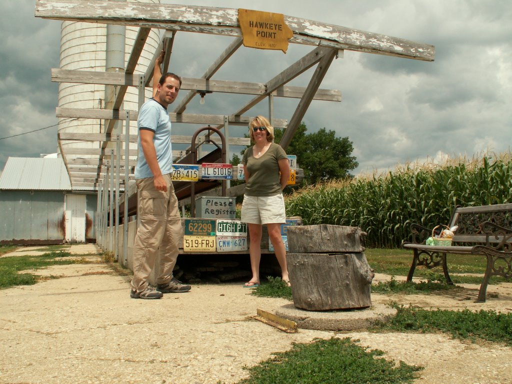
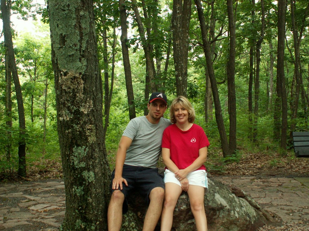
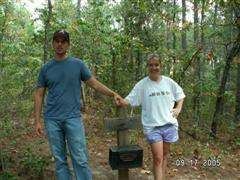
I knew coming into the year I wanted to climb high point number 41, as it had been far too long.  Mary Ruth had starting planning the trip to couple this climb at the front end of a trip to Glacier National Park with longtime Highpointing friends Kent and Jess.

We met them in Challis, Idaho and rented a house for two days, and our friend Bethany came up from SLC to watch Jake, Eyrleigh, and Rylynn.  Unfortunately Jess did not sleep a wink the night before, as she wasn't feeling well, so she stayed behind with the kids.

Though we have high-pointed a ton with Kent and Jess we have done most high points at different times and in different order, it just so happened all 3 of us were heading up high point #41.

We made the drive down to the trail head and parked the car before sun up at 6am.  After a quick potty break we were off.  The first mile was fairly mild, and it ticked away rather quickly.

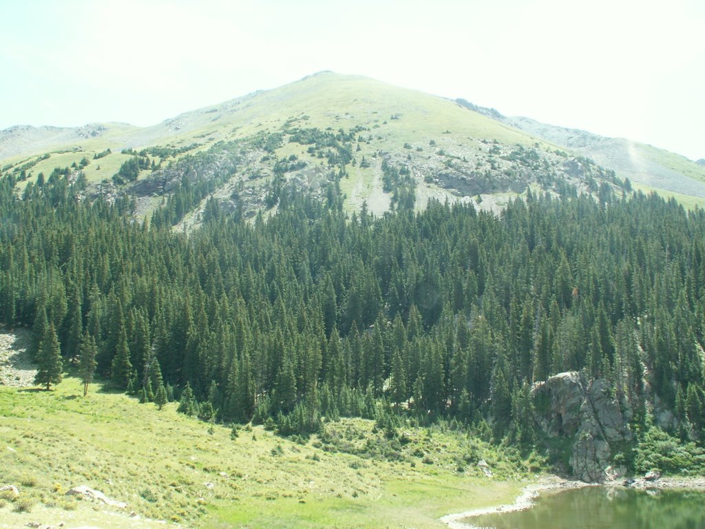
Mile 2 started the steep below and at treeline, and was rugged rock hiking, nothing horrible.

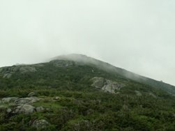
Mile 3 was Chicken Out Ridge.  Most people "Out for a day hike." turn around here.  It is slightly technical and is easy to lose the trail.  I fact we did, but we quickly found t again.  This ridge involves hand and foot rock climbing. REAL climbing.  I loved it, and we were shielded from the sun so the temps were still fairly mild.  I wish I was as smart as Kent and brought a pair of leather gloves.

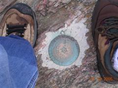
Mile 4 was high under-rated in all ascent reports we read.  at the end of Chicken Out Ridge you are at 11,300 feet high.  The last bit was a mix of steep rock climb and scree, it was tough climbing.  At mile 4.5 on my GPS we reached the summit 5 hours later.

The Summit is the size of your living room and it feels like the world falls away when you are up there.  The wind whipped and the sun shown down on the highest faces in Idaho.  Our faces.

The way down was uneventful and we made it down in around 3.5 hours.  BTW I am glad I didn't see this mountain coming to the trail head, as it is very intimidating.  Don't kid yourself, this is a tough day's work.

41 down, 9 to go.  Nevada? Do you hear us coming?  You're Next.


Sunday, August 10, 2008

Highpoint #40 AZ Humphreys Peak 12,633 ft. Rank #12

Humphrey's Peak is the highest mountain in Arizona. At 12,633ft it is a nice hike on the Humphrey's Trail. The trail is 5 miles each way, with 3,500ft of elevation gain.
A new challenge on this highpoint was not to just climb the mountain, but to be a good parent. Some of the people on the mountain thought Eyrleigh being with us was awesome and some thought we were nuts to bring our close to sea level living Georgia Peach to 12,633ft!

You see Eyrleigh was along for the ride on the child backpack. We had to feed, change diapers, and handle misc baby situations. All was good until 1/2 mile from the summit. Eyrleigh needed a nap and was sick of the baby backpack. She cried until the summit, and when we took her out she was all smiles! 20 minutes at the summit and we started back, as the clouds were starting to roll in. Eyrleigh fought sleep for the first 10 minutes and then she was out, and the hike finished with Mary Ruth making up songs to sing to Eyrleigh on the way down.

It was a fairly easy 10 mile hike, and it was a very nice day to climb this peak. The Humphreys Trail is well maintained, easy to follow, and follow it we did all the way to the top!
We arrived back at the car at 2pm, and drove into Flagstaff to have a burrito at the Black Bean. 10 Highpoints left for Mommy and Daddy, and 47 more for Eyrleigh.

Eyrleigh previously "climbed" AL and NJ. More Soon!


Friday, August 03, 2007

Highpoint #39 IL Charles Mound 1,235 ft. Rank #45

Well here we are 9 months after our last adventure on a state highpoint. This time our destination is Charles Mound, IL. This was a very frustrating highpoint for one main reason. We could have easily attained this highpoint last summer on our "Big Summer Trip" however the "summit" was closed because it was not an open weekend.

The owners of the property do not like people on the land, even though the summit is 400 yards away from thier house. It is really a shame because the 1.25 mile walk is very scenic and easy.

All private highpoint owners need to take a chapter from the book of the Iowa and Rhode Island Highpoint owners. Hawkeye Point is literally in the side yard and Jerimoth Hill is right behind the owners backyard. They choose to handle the "fame" of being a highpoint owner properly, and until the IL owners either sell/change this highpoint will simply be a checkmark on someone's list, when it could be a lot more.

On a highnote, you will notice this is our only US State highpoint for the year. We are expecting our first child (a little girl) in Nov. and the state of IL is filled in pink for her, my little girl Eyrleigh.


Saturday, December 02, 2006

Highpoint #38 TX Guadalupe Peak 8,749 ft. Rank #14

Friday December 1st.

We departed Atlanta, GA. Our destination, The Base of Guadalupe Peak, TX. However, we had a few hurdles to jump along the way.

#1 we had to drive 2.5 hours from Atlanta to Birmingham, AL (the flight was half the price).

#2 A slight delay in Houston.

#3 Jess and Kent's (our climbing partners) bags did not make the connection to El Paso and the bags weren't going to be in until 8pm.

#4 Driving to the mountain we needed fuel and matches and promptly forgot them both, until that is we were in the middle of NOWHERE. (See a previous post).

#5 Kent forgot his tent poles. This made for an interesting looking tent which we now refer to as the puppet tent. Other than that we were well on our way to climbing this mountain.

Saturday December 2nd.

On this day climbing The Mountain proved to be an easier task than getting to The Mountain. With a high 47 degrees, sunny, no wind, a great 4.3 mile trail, and views... GREAT VIEWS. After breaking camp at 9:15 and at the trailhead, we were on our way. Girls in the front guys in the back. The girls were setting a great pace, and I took many pictures. This hike is a good trail with many switchbacks. We were climbing! At every stop I asked Kent for an altitude and distance check using his Rhino. I don't have one of these (hint hint) so having this device handy was a great gauge of how the hike was going. Up up and up we went. For the last 3/10 of a mile the sky opened up, and after a quick stop near the top, I asked everyone if it would be okay if I summited first. After all, Texas is the state of my birth, and 30 years and 3 weeks after being born in a downtown Dallas hospital, I was going to be the highest Texan in the state! Even higher than W. himself! We drove on for a few minutes, and there we were THE TOP! After numerous pictures, congratulations and PB&J sandwiches, I chewed Beef Jerky, a Texas Staple. Then it was time to head down. Only 12 left!

The way down was fairly straight-forward, with the exception of the sun being blocked by Guadalupe. As 3pm hit we had descended back to the car. Thanks to my partners on the mountain, Mary Ruth, Jess, and Kent. We could have tackled a much higher peak on this day, but the Lone Star State was a great time with our newest friends.

Been there, done that and afterward I felt compelled to "Buy the T-shirt"


Next up.... Who knows?

Photos Here: http://www.flickr.com/photos/hambrick/sets/72157594405135462/

Saturday, August 05, 2006

Highpoint #37 NC Mount Mitchell 6,684 ft. Rank #16

Well, we finally did this one after much delay. You can drive this one, but we decided to do a one way hike from the Colbert's Ridge trail to Deep Gap, then Deep Gap to the Summit. Caution the juction of Colberts Ridge and the first mile of Deep Gap are not well marked. Both trails are overgrown in parts. At the primitive campground at the Deep Gap junction, stay left on the trail, not the road. That cost us 1/2 mile on our feet.

Hike here: http://hikingthecarolinas.com/black_mountains.php

Photos Here: http://www.flickr.com/photos/hambrick/sets/72157594226874495/

This hike takes you over the following peaks:

Mt. Mitchell - 6684 feet

Mt. Craig - 6648 feet

Big Tom Peak - 6581 feet

Balsam Cone - 6596 feet

Cattail Peak - 6584 feet

Potato Hill - 6475 feet

This is a somewhat strenous trail, but the best part is that after the 8 miles we didn't have to hike down. We hiked this trip with a 50 state completer, 6 of the seven summit completer, and she has been to camp IV on Everest (26,000') , Barb Gurtler. She was a blast to hike with and her husband Homer met us at the top and we "thumb hiked" back to the car. 37 down 13 to go.


Next Stop: Bring your 6 shooter, it time for a showdown in The Lone Star State.

Friday, July 28, 2006

Highpoint #36 OH Campbell Hill 1,549 ft. Rank #43

Alas, our highpointing for this trip is complete. It ended on Campbell Hill. It is a hill on a school campus. The four of us Richard, Mary Ruth, Annik, and Serge talked for a bit on the highpoint, and then off to find pizza nearby, and then to the campground for some Zzzzz's

Photos Here: http://www.flickr.com/photos/hambrick/sets/72157594216292618/

Next Up: North Carolina for sure this time! It's Konvention Time.

Highpoint #35 IN Hoosier Hill 1,257 ft. Rank #44

Hoosier Highpoint was a pull off of the road kind of deal. We walked into the woods and there it was. Number 35. Shortly after we arrived we met Serge and Annik, who were on the way to Campbell Hill, OH so we caravaned. With the help of the GPS we took an hour off of the travel time.

Photos Here: http://www.flickr.com/photos/hambrick/sets/72157594216291169/

Next Up: Ohio! (Insert ohio quip here)

Monday, July 24, 2006

Highpoint #34 MI Mount Arvon 1,979 ft. Rank #38

Today we summited Mount Arvon. It was a very un eventful summit, but getting down was its own challenge. I decided to take the road that Streets and trip told me to take. Let's just put it this way, old logging roads are very difficult to travel on, so we turned around and went back the way we came in.

Photos Here: http://www.flickr.com/photos/hambrick/sets/72157594213302192/

Next: The Hoosier State

Highpoint #33 WI Timms Hill 1,951 ft. Rank #39

After camping at Sailor Lake last night, and surviving the 2 hour long thunderstom (the tent did quite well), we awoke and broke camp. Thirty minutes later we were in the Timms Hill parking lot. We met a guy there from Wisconsin that was thinking about having his mom's 83rd birthday in the tower. As it turns out he shortly scrapped that plan after hiking the nature trail in and determined the tower was too high.

It was a nice highpoint.

Photos here: http://www.flickr.com/photos/hambrick/sets/72157594213298105/

Next up: GO TIGERS! It's Michigan.

Sunday, July 23, 2006

Highpoint #32 MN Eagle Mountain 2,301 ft. Rank #37

Today we climbed Eagle Mountain in Minnesooota, however the theme was getting sooooaked.
It was a well marked, narrow, rocky trail, 7 miles round trip. We got to the top in 1:45 and down in just over an hour. We were VERY wet, but we were able to dry off and change in the car.

We then stopped for a chai tea, and we got our feet wet in nearby Lake Superior.

Next up: HELLO WISCONSIN!

Photos Here: http://www.flickr.com/photos/hambrick/sets/72157594210533443/

Saturday, July 22, 2006

Highpoint #31 IA Hawkeye Point 1,670 ft. Rank #42

Today we visited Hawkeye Point just inside of Iowa. I felt like I was visiting in the movie the "Field of Dreams" It was a quaint piece of America none the less. Thanks to the Highpoint owners for their allowing us to do our allbeit "weird" hobby.

Photos Here: http://www.flickr.com/photos/hambrick/sets/72157594208027075/

Next up: Minnesoooooota

Friday, July 21, 2006

Highpoint #30 ND White Butte 3,506 ft. Rank #30

After visiting Mount Rushmore, we headed North to the other Dakota. At White Butte we hiked a non marked path 1 mile to the summit. The threat of rattlesnakes made this not as an enjoyable hike. We summited at 5pm.

On to Iowa, The Hawkeye State!

Photos Here:http://www.flickr.com/photos/hambrick/sets/72157594207833111/

this is an audio post - click to play


Highpoint #29 SD Harney Peak 7,242 ft. Rank #15

This morning at 6am we departed the Sylvan Lake parking area for Harney Peak via the Cathedral Spires trail. This trail gives you a workout and is very beautiful at the same time. South Dakota has one of the most interesting landscapes I have ever seen.

We summited at 7:45 am, but right before then these two guys from London were on their way down. The one guy explained he was trying to break the Guinness Record for summiting all 48 contiguous states in the fastest time. Mary Ruth wrote in his book and verified the summit. We shook hands and they left. His website is here. http://www.standardlifebank.com/html/outdoor/index.html

As it turns out, this Briton is the current Record Holder of the youngest man to summit the 7 Summits, including Everest! We shook hands with a guy that summited Everest on a mountain, not just in a store!

His website is here: http://www.jakemeyer.co.uk/

Anyway, back to the summit. This summit is very cool with a lookout tower and scenery as far as the eye can see. You can even see the back of Mount Rushmore from here. We stayed a while took pictures, then made our decent. We arrived back to the car at 9:45. Not bad for 2 people that haven't summited Everest.

Photos Here: http://www.flickr.com/photos/hambrick/sets/72157594207766481/

Got Rattlesnake? North Dakota is next.

Thursday, July 20, 2006

Highpoint #28 NE Panorama Point 5,424 ft. Rank #41

After yesterday, this "summit" was anti-climatic. However, it was windier on Panorama Point than Mount Elbert yesterday.

Tomorrow is Dakota Day North and South, and we will see Mount Rushmore.

Photos Here: http://www.flickr.com/photos/hambrick/sets/72157594207690819/

Wednesday, July 19, 2006

Highpoint #27 CO Mount Elbert 14,433 ft. Rank #3

Today we ( Richard, Mary Ruth, and Alice) climbed the Colorado Trail to The North Mount Elbert Trail. We hiked the highest 1,272 feet of our hiking career (after yesterday). The summit trail was steep, but good footing. The saving grace of this hike was the scenery. We left the car at 9am and returned at 5 pm. This is our highest highpoint to date.

Mount Elbert is the 2nd highest peak in the Continental US. Now we are climbing! I'm still in disbelief.

Photos here: http://www.flickr.com/photos/hambrick/sets/72157594205462183/

Next up Nebraska... Panorama Point (From Rockies to Corn. Go figure)

this is an audio post - click to play


Tuesday, July 18, 2006

Highpoint #26 NM Wheeler Peak 13,161 ft. Rank #8

Today we climbed the Williams Lake Trail to Williams Lake. We then hiked the toughest .9 miles of our hiking career. 2,000 feet of elevation gain in the .9 mile. The summit trail was steep and loose rocks. The saving grace of this hike was the wildlife. We left the car at 6am and returned at 12:30 pm. This is our highest highpoint to date... until tomorrow.

Photos here: http://www.flickr.com/photos/hambrick/sets/72157594204210790/

Next up Colorado... Mount Elbert (top of the Rockies)

Monday, July 17, 2006

Highpoint #25 OK Black Mesa 4,973 ft. Rank #23

This part of Oklahoma is beutiful. So many animals on this 8.6 mile hike. Cows, horn toads, jack rabbits, cotton tails, and mule deer. We got up early and hiked before the sun started to burn the air. A OK view on top (no pun intended), but coming up was better.

Next up New Mexico. Corona Time.

Photos Here: http://www.flickr.com/photos/hambrick/sets/72157594204192342/

Sunday, July 16, 2006

Highpoint #24 KS Mount Sunflower 4,039 ft. Rank #28

We are in the middle of the plains on "Top" of Kansas, and there is not a cloud in the sky. You may think we could see forever, but you can't see alot of land formations or "mountains". Good thing the land owners have a good sense of humor about "The Mountain" here. BTW it is really hot here 100+

Next up Oklahoma.

Photos Here: http://www.flickr.com/photos/hambrick/sets/72157594204148763/

Saturday, July 15, 2006

Highpoint #23 MO Taum Sauk Mountain 1,772 ft. Rank #41

Today we drove from Atlanta to Taum Sauk State Park, and setup camp. We walked to the highpoint and the lookout tower a mile away. This is not a difficult highpoint. Legs optional on this one.

Next up Kansas.

Photos Here:
http://www.flickr.com/photos/hambrick/sets/72157594199821056/

Saturday, July 01, 2006

Highpoint #22 NY Mount Marcy 5,344 ft. Rank #21

Getting there:

On June 30th we departed Piermont, NH to complete the New York Highpoint. We cut through the center of Vermont into New York State. Outside of Lake Placid is the Van Hovenburg Recreation Area, it is also our destination.

Preparation:

After hiking in 3 miles, setting up camp and making dinner, we decided to retire early. At 6 am we woke up and decided to make an early departure. It is Mary Ruth's Birthday!

The Van Hovenburg Trail:

The Van Hovenburg Trail is a mud covered trail. The most notable thing about the trail is that the last 1 mile of the trail is exposed. Winds were steady at 30mph. At the top of the trial, 7.4 miles later, is the summit. The clouds were moving in and the temperature was noticeably lower. summit time 10:45 am.

Coming Down:

The last half consisted of non-technical trudging through the mud to camp. We broke camp and hiked the last 3 miles to the car. 14.8 miles round trip.

The Car:

We made it out in 1 piece. We did check out at 5:15pm and left for hamburgers.

Next up Missouri. I can't wait for the .4 mile trip walk after this week.


Photos Here.
http://www.flickr.com/photos/hambrick/sets/72157594188213862/

Wednesday, June 28, 2006

Highpoint #21 ME Mount Katahdin 5,267 ft. Rank #22

Getting there:

On June 27th we departed Piermont, NH to complete the final New England Highpoint. We passed the Presidential Mountain Range, Mount Washington included, and on to Route 2 into Maine. After stopping for lunch at Bob's Roadside BBQ we continued on Route 2 to 95 North in Bangor. Straight up 95 we continued to 157 E into Millinocket. Outside of Millinocket follow the signs to Baxter State Park entrance. That was where we saw the only Moose of the trip.

Preparation:

After setting up camp and making dinner we decided to warm up our legs and to see Moose. Needless to say we took the wrong trail for the Moose, the Roaring Brook Scenic trail. It was a nice little hike any way. Off to sleep (9pm)... At 4:45am we woke up and decided to make an early departure. We ate, dressed, broke down camp, moved the car and departed by 6:15 am

The Helon Taylor Trail:

The Helon Talyor Trail is a steep exposed trail. The most notable thing about the trail is that the last 1.3 miles of the trail is Very Exposed. Winds were steady at 30mph. At the top of the Helon Taylor is Pamola Peak (4,902). The clouds were moving in and the temperature was noticeably lower.

The Knife Edge:

Ok kids, here is where it gets interesting. This section is a test of your physical and mental climbing ability. Both sides are almost completely exposed and in some sections the path is only 3 feet wide in some parts. My descriptions nor the pictures do this section justice. If you want to truly climb this mountain, this route is the "creme de la creme" of this mountain. More rock scrambling to Chimney Peak 4,840'. Yet more descending and climbing... South Peak 5,240'. Finally, to Baxter Peak 5,267', the northern terminus of the AT. What a ride, but little did we know what was left. Summit time 11:21 am.

The Saddle:

The Saddle Trial is basically the less scenic, but just as difficult summit option. The trail itself is a fairly steep treacherous rock slide. Watch those ankles on this one. The great part about this trail is that you can see the entire Knife Edge on the way down.

The Chimney Pond Trial:

You join the Chimney Pond to return to the Roaring Brook Campground in 3.3 miles. By this time it was raining and this trial became a slog to get back to the car and out of the park. Katadhin had thoroughly worn us out with its many different terrains.

The Car:

We made it out in 1 piece. We did check out at 5:20pm and left for pizza. YAY Pizza!

The Pizza and Drive Home:

We happened upon this village pizza run by this Greek family in Palmyra, ME and devoured an order of onion rings and a large pizza inside of 15 minutes. We then hit the road and returned home at 1am.

Next up New York. I need a bear canister.


Photos Here.

http://www.flickr.com/photos/hambrick/sets/72157594187372936/

Saturday, February 04, 2006

Highpoint #20 AR Mount Magazine 2,753 ft. Rank #34

Today Mary Ruth, My Mom and I hiked the 1/2 mile trail each way to reach the summit. My mom lives in Fort Smith, Arkansas, and yesterday she celebrated her 69th birthday. It is our 20th highpoint and my mom's first highpoint. It was a very clear day and crisp (in the low 50s and windy.) North Carolina's Mount Mitchell is next on the radar screen.

Photos Here:
http://www.flickr.com/photos/hambrick/sets/72057594059250249/

Sunday, December 18, 2005

Highpoint #19 VA Mount Rogers 5,739 ft. Rank #19

Mount Rogers is our favorite highpoint to date. The weather was cool, but sunny. We hiked most of the way up surrounded by ponies on the mountain. With the exception of one of the ponies grabbing Mary Ruth's jeans with its teeth the trip was safe. The views up and back during our 8.6 mile hike in 3-4 inches of snow were amazing. After not being able to find the usgs marker in Kentucky I was determined to find it at the top, and after 15 minutes of snow clearing we found it. I think Arkansas is next when we visit mom in February.

Photos Here: http://www.flickr.com/photos/hambrick/sets/1616048/

Saturday, December 17, 2005

Highpoint #18 KY Black Mountain 4,139 ft. Rank #27

How nature has a way of changing your plans. Due to ice on the back roads and road construction on the Blue Ridge Parkway, Mount Mitchell was inaccessible. So on to Kentucky. We drove from Atlanta to a coal mining town in Virginia. And right across the border in Kentucky was the road to the top. Black Mountain is an active coal mine, so hiking on the mountain is not allowed. We spent more time at the top trying to find the USGS marker, but we never did because of snowcover. Tomorrow we hike Mount Rogers, VA

Photos Here: http://www.flickr.com/photos/hambrick/sets/1601130/

Saturday, December 03, 2005

Highpoint #17 WV Spruce Knob 4,863 ft. Rank #24

Now to the mountain state. After lunch and watching the end of the 3AAA West Virginia High School championship game with 3 local hunters we started toward Spruce Knob. I now know why they call West Virginia the mountain state! Driving through that area makes you feel small. At 4:30 pm we completed the Trifecta, and there were great view from the observation tower, but after that we started our decent with NO GAS. So instead of a celebration ensuing we were driving through the middle of nowhere on fumes. I want to take this opportunity to thank the great gas company Chevron! Thank you Chevron for indeed putting a gas station IN the middle of nowhere. Up next NC, KY and VA in two weeks!

Photos Here: http://www.flickr.com/photos/hambrick/sets/1511874/
Highpoint #16 MD Backbone Mountain 3,360 ft. Rank #32

From Mount Davis we departed to Backbone Mountain. An hour and a half later we arrived to the logging road. This was the start of the trail. After a mile hike through the snow we arrived at the summit. It seemed like a longer hike with the snow on the ground. The top featured a nice view, and after signing the register we started down. On the way we passed two teenage hunters. What is with us highpointing and having people brandishing weapons while on these hikes? Back to the car and on our way to the West Virginia HP to complete the one day trifecta.

Photos Here: http://www.flickr.com/photos/hambrick/sets/1507827/
Highpoint #15 PA Mount Davis 3,213 ft. Rank #33

On Saturday, December 3rd, 2005 We started our journey early, leaving our friend Karen's house at 7:15 a.m. Our first destination was Mount Davis, PA. We drove from Pittsburgh to Mount Davis, and luckily we did not wear our antler hats as dear season was in full swing on Mount Davis. Other than a rickey lookout tower, the first leg of our mission was successful

Photos Here: http://www.flickr.com/photos/hambrick/sets/1507806/

Sunday, November 13, 2005

Highpoint #14 TN Clingman's Dome 6,643 ft. Rank #17

On Sunday, November 13th we left Atlanta and Drove 157 miles to a spot on Clingman's Dome Road. The Smokey Mountains were "Smokey" on this day. We parked by Collin's Gap and joined the AT and hiked 4 miles up to Clingman's Dome. If the fog wouldn't let us see out the trees would have blocked our view. Back in Atlanta at 9pm with number 14 under our belt.

Photos Here: http://www.flickr.com/photos/hambrick/sets/1361551/

Sunday, September 18, 2005

Highpoint #13 MS Woodall Mountain 806 ft. Rank #47

On the way back to Atlanta, we took what ended up being a 4 hour detour to get to Woodall Mountain. We drove right to the top. Pictures here. http://www.flickr.com/photos/hambrick/sets/979372/

Saturday, September 17, 2005

Highpoint #12 LA Driskill Mountain 535 ft. Rank #48

During our Trip to See Uncle Dick and Aunt Evelyn in LA, we took a 2hr round-trip to Driskill Mountain. Although it was fun to do, The real highpoint of this trip was to see Uncle Dick and Aunt Evelyn. We love you. Full Pictures here. http://www.flickr.com/photos/hambrick/sets/979358/

On another note, this was the most dangerous highpoint to date. When we got to the top of Driskill there was a guy and his girlfriend? and he was carrying a firearm.

Remote location + loaded weapon + crazy man = dead highpointers.
fortunately the crazy man was not in the equation.

Monday, September 05, 2005

Highpoint #11 RI Jerimoth Hill 812 ft. Rank #46

The highpoint has been opened with the new owners and it is open every day of the year to highpointers. We stopped just to check the highpoint off of the list, and we ended working with the other highpointers to fix up the trail for 4 hours. We also received our 5 highpoint patch in a belated ceremony on the Rhode Island Highpoint. Full pictures here. http://www.flickr.com/photos/hambrick/sets/899638/

Saturday, August 27, 2005

Highpoint #10 SC Sassafras Mountain 3,560 ft. Rank #29

120 miles from our home in Lawrenceville, GA is Sassasfras Mountain so we took a day trip. We hiked a 2.5 mile section of the foothills trail. (That's 5 miles round trip) No view at the top, but a great day nonetheless Full photos here. http://www.flickr.com/photos/hambrick/sets/851454/

Sunday, August 21, 2005

Highpoint #9 FL Britton Hill 345 ft. Rank #50

Today, August 21, 2005 we "summited" Britton Hill, the "highpoint" in Florida. Britton Hill , FL is the lowest highpoint of the 50 states. Our camera gave up the ghost as of yesterday so a new digital camera is in our future. These pictures were taken with the ever inferior camera phone. An interesting fact, this is the first highpoint in which we started the day at sea-level in Pensacola, FL. 9 down 41 to go. Full photos here. http://www.flickr.com/photos/hambrick/sets/851393/


Saturday, July 23, 2005

Highpoint #8 DE Ebright Azimuth 448 ft. Rank #49

The 49th rank "highpoint" was a tough hike 20ft. from where we parked the car at the entrance to the neighborhood. Full photos here. http://www.flickr.com/photos/hambrick/sets/851403/

Friday, July 22, 2005

Highpoint #7 NJ High Point 1,803 ft. Rank #40

A Drive-up highpoint. We did climb from the parking lot and walked all 292 stairs to the top of the tower. Full photos here. http://www.flickr.com/photos/hambrick/sets/851416/

Wednesday, July 20, 2005

Highpoint #6 VT Mount Mansfield 4,393 ft. Rank #26

This hike was the most picturesque so far, and that is a huge compliment to this mountain based on the great weather we had on Mt. Washington. We hiked to the trailhead and onto the Sunset Ridge Trail. Then it was up to the "chin" to summit. After the summit we hiked along the top of Mansfield, taking in the surrounding states of NY, VT and NH, as well as Canada. We hiked around 9 miles, and it took 6 hours round trip. Full photos here. http://www.flickr.com/photos/hambrick/sets/850820/


Monday, July 18, 2005

Highpoint #5 CT Mount Frissell South Slope 2,380 ft. Rank #36

2 hours later we arrived and hiked the 2 mile round trip summit trail. 2 highpoints in 1 day. We were soaked after this hike! Full photos here. http://www.flickr.com/photos/hambrick/sets/850778/

Highpoint #4 MA Mount Greylock 3,491 ft. Rank #31

First hike of our two highpoints in one day. We drove to the top of the Highpoint, but we hiked a 2.5 mile lookout trail, and a section of the AT. Then onto Connecticut... Full photos here. http://www.flickr.com/photos/hambrick/sets/850541/


Friday, July 15, 2005

Highpoint #3 NH Mount Washington 6,288 ft. Rank 18

The hike was on the Jewell Trail, then 1.4 miles on the AT to the summit. This hike took 7 hours round trip. This was a real hike, and it was worth every minute. Full photos here. http://www.flickr.com/photos/hambrick/sets/847234/

http://hikenh.netfirms.com/TDJewell.htm

Saturday, January 15, 2005

Highpoint #2 GA Brasstown Bald 4,784 ft. Rank #25

We have climbed Brasstown Bald on 2 seperate occasions. First, in January and for the 2nd time in April. Climb #1 was a half mile hike each way. Climb #2 was a 3.5 mile hike each way. We went to the Tour de Georgia and to see Lance Armstrong. So the SPUR road was closed. So we hiked the spur road and the summit trail up and down. Full photos here. http://www.flickr.com/photos/hambrick/sets/846931/

Saturday, January 08, 2005

Highpoint #1 AL Cheaha Mountain 2,407 ft Rank #35

We took the Rock Garden Trail to the top of the mountain. The fog was thick, but we later drove to take clearer pictures. Full Photos here. http://www.flickr.com/photos/hambrick/sets/832484/